

Floods are becoming more frequent and more severe across the Mediterranean, yet wetlands remain one of the most overlooked forms of natural infrastructure for reducing flood risk. Their ability to slow water, store flood flows and reconnect river dynamics depends not only on the condition of individual wetlands, but on the functioning of entire catchments.
Within the Wetland4Change project, Tour du Valat led the development of a harmonised methodology to assess flood regulation across five Mediterranean pilot sites (see previous interview). By combining Earth Observation, GIS and spatial modelling, the project moved beyond traditional wetland inventories to create a functional assessment of where ecosystems currently reduce flood risk, where restoration can provide the greatest benefits, and how these results can support future planning and climate adaptation.
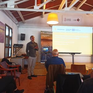
In this interview, Anis Guelmami and Michael Ronse from Tour du Valat explain the scientific framework behind the project, discuss how satellite data are transforming the assessment of ecosystem services, and reflect on the legacy of Wetland4Change for wetland conservation, flood resilience and Nature-based Solutions across the Mediterranean.
What you will find in this interview
This interview explains how wetlands can help reduce flood risk across Mediterranean catchments, and how Wetland4Change used satellite data, GIS and spatial modelling to better understand where wetlands already protect communities and where restoration could deliver the greatest benefits.
Jump directly to the main themes:
- Wetlands as natural infrastructure for flood regulation
- How satellite data and modelling improve flood assessment
- Remote sensing and GIS at catchment scale
- Identifying priority areas for protection and restoration
- Different wetland types and their flood regulation role
- The role of hydrological connectivity
- Limitations and uncertainties of satellite-based assessments
- How these tools support land and water management
- The legacy of Wetland4Change
Key message: restoring and reconnecting wetlands is not only an environmental priority, but also an investment in safer and more resilient territories.
Michael Ronse – Tour Du Valat
Looking across all pilot sites, what is the most important lesson you have learned about wetlands’ role in flood regulation?
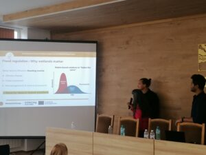
One of the clearest lessons emerging from the pilot site assessments and exchanges with local stakeholders is that wetlands regulate floods not as isolated ecosystems, but as components of broader hydrological systems operating at the catchment scale. Across delta systems, lagoons, river floodplains, streams, and lakes, we consistently observed that ecosystem-based flood regulation depends not only on the condition of wetlands themselves, but also on their interactions with surrounding landscapes, hydrological connectivity, and broader upstream-downstream dynamics. In these conditions, wetlands and other hydrologically functional ecosystems can temporarily store excess water, slow runoff, dissipate flood energy, and reduce downstream flood peaks.
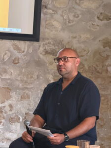
Anis Guelmani speaks at the Wetland4Change’s partners’ meeting in Sofia, March 2024
This also means that flood regulation capacity does not depend solely on the condition of the wetland itself, but on the surrounding landscape and broader hydrological dynamics. Land-use change, soil sealing, upstream drainage, river canalisation, and wetland fragmentation can significantly reduce the ability of wetlands to mitigate floods, even where wetland ecosystems still appear relatively intact.
Wetland4Change reinforced the idea that wetlands should not only be viewed as biodiversity hotspots, but also as strategic natural infrastructure for climate adaptation, disaster risk reduction, and territorial resilience. Protecting and restoring wetlands can complement existing grey infrastructure, reduce the need for costly new engineering solutions, and strengthen the resilience of both ecosystems and human communities.
One of the major added values of Wetland4Change is that the landscape-scale approach developed in the project not only helps assess the role played by existing wetlands today, but also helps reveal the important flood regulation functions that may have been lost through historical wetland degradation, drainage, and land conversion. By identifying these potential hydrological disconnections and lost retention areas, the methodology also provides a valuable tool for identifying where wetland restoration or even wetland recreation could maximize the effectiveness of nature-based solutions and improve resilience at the scale of entire river basins
How has the integration of satellite data and modelling changed the way we assess flood regulation capacity compared to traditional approaches?
Traditionally, flood regulation assessments often relied on local field observations, fragmented datasets, or hydraulic studies focused on specific flood events. While these approaches remain essential, they are often difficult to compare across regions and can be highly data-, time-, and resource-intensive.
The integration of satellite data, GIS, and spatial modelling has fundamentally changed this by allowing us to assess flood regulation capacity more consistently across large and diverse territories. Through Earth Observation data and harmonized spatial indicators, we can now move beyond static ecosystem inventories toward functional spatial assessments of flood regulation across entire river basins, rather than focusing only on individual wetlands or site-specific flood events. This means the analysis is not limited to where wetlands are mapped, but helps identify where ecosystems and hydrologically functional landscape elements effectively contribute to flood attenuation based on their ecological, hydrological, and spatial characteristics.
This approach also significantly improves replicability, scalability, and accessibility. One of the major strengths of the Wetland4Change methodology is that it combines relatively accessible and, in many cases, freely available datasets, such as land cover, topography, flood hazard maps, surface water dynamics, and hydrological information, into a framework that can be reproduced in very different environmental and socio-economic contexts.
Importantly, this also strengthens the capacity of local actors, practitioners, and public authorities to take ownership of the framework themselves. By relying on widely accessible geospatial data and reproducible GIS-based methods, the project helps provide stakeholders with practical tools to independently assess flood regulation capacity at the catchment scale and better understand the role wetlands play in reducing flood risks across their territories.
Satellite-based approaches also allow us to better capture landscape dynamics, including hydrological connectivity, surface water persistence, vegetation patterns, floodplain functioning, and flood-prone areas. This provides a much more integrated understanding of how wetlands interact with floods across the landscape.
Beyond improving scientific assessments, these tools help bridge the gap between research and operational decision-making by making flood regulation analyses more accessible, transferable, and actionable for local and regional stakeholders.
What added value do tools like remote sensing and GIS bring in understanding wetland functioning at the catchment scale?
Remote sensing and GIS allow us to move from a site-based vision of wetlands toward a true landscape-scale understanding of hydrological processes.
Wetlands are strongly influenced by what happens upstream and downstream. With spatial modelling tools, we can analyse how water moves across entire catchments, identify flood-prone areas, evaluate runoff generation, and assess how ecosystems interact with topography, soils, vegetation, and human infrastructure.
These tools also make it possible to integrate multiple layers of information into a single assessment framework. In Wetland4Change, this allowed us to combine flood hazard, land use, hydrological characteristics, water retention potential, and human exposure into coherent spatial analyses. In practical terms, this translates into complementary spatial outputs on ecosystem-based flood regulation supply, flood regulation demand, and their interaction, helping identify where ecosystems currently contribute most to flood mitigation, where exposure and societal need are highest, and where intervention may be most strategic.
Another major added value is the possibility to identify spatial patterns that would be extremely difficult to observe only through fieldwork. For example, remote sensing helps detect hydrological disconnections, artificial drainage, changes in inundation dynamics, or degraded floodplain functionality over large territories and over time.
Importantly, GIS-based tools also facilitate communication with decision-makers because results can be translated into maps and visual indicators that directly support territorial planning and restoration prioritisation.
Are you now able to identify priority areas for protection or restoration more effectively thanks to this modelling approach?
Yes, this is one of the major strengths of the methodology developed within Wetland4Change.
By combining flood regulation capacity indicators with flood exposure and vulnerability indicators and potential wetlands and restorable areas, we are now better able to identify where wetlands currently provide critical flood mitigation services, but also where restoration efforts could maximize flood regulation services and generate the greatest cobenefits for both ecosystems and human communities.
The modelling framework helps distinguish:
wetlands that already play a key role and should therefore be prioritised for protection,
degraded or hydrologically disconnected areas where restoration or reconnection could significantly improve flood regulation capacity,
historically lost retention areas where wetland recreation or broader nature-based interventions could restore ecosystem-based flood mitigation functions,and highly exposed flood-prone zones where nature-based solutions could complement existing risk management strategies.
This is particularly important because resources for restoration are often limited. By moving beyond the assessment of currently mapped wetlands alone, the approach also helps reveal where ecosystem-based flood regulation potential may have been reduced through historical land conversion, drainage, or floodplain disconnection. Spatial prioritisation helps ensure that investments are directed toward areas where ecological restoration can also deliver tangible socio-economic benefits.
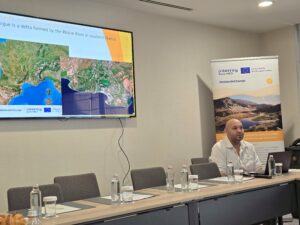
Anis Guelmami during the last Wetland4Change meeting in Camargue
How do different wetland types—lagoons, river systems, and delta areas—compare in their capacity to regulate floods?
Different wetland types and hydrologically functional ecosystems contribute to flood regulation in different but highly complementary ways. One of the key lessons from Wetland4Change is that flood regulation capacity depends not only on ecosystem type itself, but also on catchment configuration, topographic context, hydrological connectivity, and the interaction between ecosystems and surrounding landscapes.
Riparian forests, marshes, peatlands, wet meadows, floodplain wetlands, lakes, lagoons, and delta systems all contribute differently to water regulation processes. Some ecosystems are particularly important for slowing runoff and promoting infiltration, while others play a major role in temporarily storing excess water, reducing flood peaks, dissipating flow energy, or progressively releasing water downstream.
For example, riparian forests and vegetated wetlands can significantly reduce water velocity, stabilize soils, and enhance infiltration capacities. Lakes, marshes, and large floodplain wetlands often act as natural retention areas capable of storing important water volumes during extreme rainfall events. Delta systems and lagoons also play an important role by distributing and buffering water across large low-lying areas and regulating exchanges between riverine, coastal, and groundwater systems. Even smaller wetlands distributed throughout the basin can collectively play a major role by intercepting and slowing water transfers before floods intensify downstream.
The comparative assessment also showed that flood regulation opportunities differ significantly between Mediterranean catchment types. Mountainous and valley-constrained systems tend to show more spatially concentrated areas of ecosystem-based flood regulation capacity, whereas lower-gradient downstream, floodplain, deltaic, or coastal systems often offer broader opportunities for temporary water retention and flood attenuation across the landscape.
One of the important findings from the project is that wetlands should never be considered in isolation. Their effectiveness strongly depends on the broader landscape mosaic and hydrological connectivity between ecosystems. Other natural habitats, particularly forests and semi-natural areas, also contribute to reducing runoff and regulating water flows across the catchment.
There is therefore no single “best” wetland type for flood regulation. What matters most is the diversity, spatial distribution, connectivity, and ecological condition of wetlands and other natural habitats across the catchment, as their flood mitigation functions are highly complementary and context-dependent. Maintaining and restoring this network of natural infrastructures is essential to maximize their complementary roles in flood prevention, flood mitigation, and long-term climate resilience.
What role does hydrological connectivity play across the different pilot sites, and how clearly can it now be mapped and quantified?
Hydrological connectivity is widely recognized as an important process influencing flood regulation capacity across landscapes, and the Wetland4Change comparative assessment further reinforced its relevance across the pilot sites. One of the key lessons emerging from the analysis is that flood regulation capacity cannot be understood solely through the presence or extent of wetlands themselves, but must be interpreted in relation to broader hydrological configurations, landscape structure, and ecosystem interactions at catchment scale.
However, it is important to clarify that directly mapping and quantitatively assessing hydrological connectivity was not the primary objective of the Wetland4Change flood regulation framework. The methodology was primarily designed to assess flood regulation capacity through spatial indicators related to land cover, runoff generation potential, topography, flood-prone areas, and exposure at catchment scale.
That said, some components of the approach indirectly account for processes related to hydrological connectivity, notably through terrain analysis, floodplain proximity, runoff modelling, and broader hydrological spatial patterns. As a result, the framework can help identify landscape configurations where hydrological interactions are likely to play an important role in ecosystem-based flood regulation capacity, including flood retention areas, floodplain-associated systems, or areas where hydrological disconnection may potentially reduce ecosystem functioning.
A more explicit and dedicated quantification of hydrological connectivity would nevertheless represent an important avenue for future methodological development, particularly to better support wetland restoration planning, floodplain reconnection strategies, and the identification of priority intervention areas for nature-based flood resilience.
What are the main limitations or uncertainties still associated with satellite-based flood regulation assessments?
Despite major progress, several limitations and uncertainties remain. It is important to understand that these approaches are fundamentally modelling exercises that aim to represent highly complex ecological and hydrological processes through simplified spatial indicators and widely available geospatial datasets.
To ensure high applicability and reproducibility across different territories, the Wetland4Change methodology was intentionally designed to balance relatively low technical and data requirements with sufficient ecological and hydrological realism at the catchment scale. However, this also means that some processes must necessarily be simplified.
One important limitation is that satellite-based approaches can only capture processes that are observable or measurable through Earth Observation and GIS data. Wetland functioning varies seasonally and can be strongly influenced by local conditions that are difficult to fully represent remotely, such as groundwater interactions, underground hydrology, soil saturation dynamics, small hydraulic infrastructures, or local management practices.
In addition, the quality, resolution, and availability of spatial data can vary significantly between regions, which may influence the precision of the assessments. Some hydrological and ecological processes also remain difficult to detect accurately from satellite imagery alone, particularly at fine spatial or temporal scales.
Finally, modelling results always depend on methodological assumptions, classification choices, and input data quality. This is why validation remains essential. While Wetland4Change did not systematically conduct field validation campaigns for pilot sites, the project strongly relied on exchanges with local stakeholders, experts, and site managers to discuss, contextualize, and validate the relevance and realism of the outputs produced.
These assessments should therefore be seen as robust decision-support and prioritisation tools at the catchment scale, but they should ideally be complemented by local expertise, field observations, and more detailed studies when supporting concrete restoration or management action
How can these modelling tools support real decision-making processes for land and water management?
One of the main objectives of Wetland4Change is precisely to help translate scientific assessment into more operational decision-support tools for land and water management.
The modelling outputs help identify where ecosystems currently provide important flood regulation capacity, where flood exposure and associated demand are highest, and where mismatches between ecosystem-based flood regulation capacity and societal needs may indicate priority areas for intervention. This can directly support land-use planning, flood risk management strategies, river basin management plans, wetland conservation prioritisation, restoration planning, and broader climate adaptation policies.
An important added value of the approach is that it moves beyond purely descriptive ecosystem mapping toward a more functional spatial assessment of ecosystem-based flood regulation. Rather than focusing only on mapped wetland extent, the methodology helps identify where ecosystems and other hydrologically functional landscape elements may contribute to runoff attenuation, temporary water retention, and flood mitigation across the catchment.
This also helps promote more integrated catchment-scale planning approaches. Instead of considering flood protection only through engineered infrastructure, decision-makers can better understand where ecosystem-based solutions may complement existing risk management strategies and contribute to strengthening overall territorial resilience.
This is particularly relevant for restoration planning, as the framework can help identify degraded, disconnected, or potentially restorable areas where ecosystem-based interventions may strengthen flood resilience and generate broader co-benefits for both ecosystems and human communities.
Importantly, these tools are not intended to replace detailed hydraulic studies or local expertise, but rather to provide strategic spatial decision-support indicators that help guide prioritisation, dialogue, and more integrated planning at catchment scale. The visual and spatial nature of the outputs is also particularly valuable for facilitating communication between scientists, planners, public authorities, site managers, and policymakers.
If you had to summarise the legacy of Wetland4Change for flood regulation in one message, what would it be?
Wetland4Change helps demonstrate that wetlands should not be seen only as biodiversity assets, but as strategic natural infrastructure contributing to flood resilience, climate adaptation, and territorial safety.
One of the project’s key legacies is the development of a harmonised, scalable, and transferable framework that helps move beyond static ecosystem inventories toward more functional, catchment-scale assessments of ecosystem-based flood regulation. By translating complex ecological and hydrological processes into accessible spatial decision-support tools, Wetland4Change helps bridge the gap between ecosystem science and practical planning, supporting more integrated approaches to wetland conservation, restoration, and flood resilience management.
Ultimately, Wetland4Change reinforces a key message: restoring and reconnecting wetlands is not only an environmental priority it is also an investment in safer and more resilient territories.
