

Floods are among the most frequent and damaging natural hazards in the Mediterranean, and climate change is expected to make extreme rainfall events even more intense. Traditionally, flood risk management has relied on engineered infrastructure such as dams, levees and drainage systems. Yet wetlands provide a complementary and often underestimated service: they naturally absorb, store and slowly release excess water, reducing flood peaks and increasing landscape resilience.
Within the Wetland4Change project, researchers developed an ecosystem-based methodology to assess flood regulation across five Mediterranean pilot catchments (see previous article on this matter). By combining hydrological modelling, Earth Observation data and detailed wetland mapping based on the Ramsar classification, the project identifies where wetlands contribute most effectively to flood mitigation and where conservation or restoration actions can generate the greatest benefits for both ecosystems and society.
In this interview, Eleni Fitoka from the Greek Biotope/Wetland Centre (EKBY) explains how wetlands complement traditional flood protection infrastructure, why flood regulation must be assessed at the catchment scale, and how the project’s findings can support future flood risk management policies and nature-based solutions in the Strymon River basin and beyond.
What would you say is the main distinguishing feature of the Wetland4Change flood regulation assessment compared to the Flood Risk Management Plans developed under the EU Flood Directive?
One of the key distinguishing features of the Wetland4Change flood regulation assessment is the explicit integration of wetlands’ capacity to absorb, store, and regulate excess water — a component that is not sufficiently captured in conventional Flood Risk Management Plans developed under the EU Flood Directive.To address this gap, we adopted an ecosystem-based approach that identifies where ecosystems can contribute most effectively to flood attenuation, where flood exposure and societal demand are highest, and where mismatches between ecological capacity and flood regulation demand to indicate priority areas for intervention.
To support this assessment, we incorporated detailed spatial mapping of wetland ecosystems into existing land cover datasets across the five pilot hydrological basins. This mapping was carried out using Earth Observation products and aligned with the standardized Ramsar wetland typology, ensuring both consistency and ecological relevance across all five pilot areas.
How did the updated land cover and land use information contribute to the assessment process? How do flood regulation functions vary among different types of wetlands?

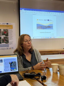
Eleni Fitoka and the Wetland4Change team at Lake kerkini last December 2025
The updated land cover and land use information proved highly valuable throughout all phases of the assessment, as these characteristics are fundamental to understanding and evaluating flood regulation processes. By integrating detailed wetland ecosystem distribution data, we gained a much clearer understanding of the role wetlands play in hydrological dynamics and runoff generation across the basin.
In addition, the updated datasets enabled us to assess how different land cover types contribute to flood mitigation. In particular, they allowed us to evaluate the capacity of specific wetland types to absorb excess water, reduce flood impacts in high-risk areas, and regulate water flows. These functions vary depending on several factors, including the wetland’s location within the basin — for example, whether it is situated upstream or downstream — as well as its vegetation structure, such as tree-dominated or reed-dominated systems, and its overall water retention capacity.
Different wetland types perform distinct hydrological functions. Some wetlands act primarily as sinks, such as lakes and ponds, where water accumulates and is stored. Others function more like sponges, such as marshes, absorbing and slowly releasing excess water. There are also wetlands that serve as conveyance pathways, including streams and channels, which help direct and regulate water movement throughout the basin. Understanding these varying roles is essential for accurately assessing flood regulation capacity and the potential of ecosystem-based mitigation measures.
Kerkini Reservoir is often mentioned in discussions about the Strymon catchment in Greece. Why is it so important? Does flood regulation depend only on Lake Kerkini? Do the results of the Wetland4Change flood regulation assessment help prioritize wetland conservation and restoration actions in the area?
The Strymon River basin is a transboundary catchment shared by Bulgaria and Greece. It drains mountainous and semi-mountainous regions before discharging into the Strymonikos Gulf in Greece. The Greek section of the basin includes the Kerkini Reservoir, which was constructed in 1932 primarily for flood protection and irrigation water supply. Over time, however, it evolved into a multifunctional wetland system of high ecological value, leading to its designation in 1975 as a Wetland of International Importance under the Ramsar Convention.
While Kerkini is undoubtedly the dominant regulating structure at the basin scale, downstream wetland systems are equally important. After the lake, the river enters a low-gradient alluvial plain where flood peaks and prolonged high-water periods can create severe pressure on agricultural land, settlements, and infrastructure. In these downstream areas, wetlands act as natural retention zones: they slow floodwaters, temporarily store excess water, and reduce the intensity of flood impacts.
Eleni Fitoka EKBY | Wetland4Change
The improved understanding of the different roles played by wetland ecosystems within the Strymon River basin provides a strong basis for prioritizing conservation and restoration actions. Beyond Lake Kerkini itself, a considerable extent of wetland ecosystems have been identified as core ecosystems with a strategic role in flood regulation. These include a mosaic of wetland types including inland marshes (of some 350,000 hectares) and riparian marshes along the Strymon riverbed (of some 138,000 hectares).
Seasonally flooded agricultural zones, although smaller in extent, also contribute significantly to temporary water storage during peak flood events and artificial ponds support local flood regulation functions.
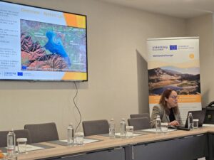
Eleni Fitoka EKBY | Wetland4Change | Wetland Flood Regulation
At basin scale, we estimated the total extent of wetlands and associated aquatic ecosystems within the Greek section to cover only 2.2% of the area, while wetland coverage across the entire transboundary catchment is even lower, at 1.2%. Given that hydrological studies suggest that wetlands may need to occupy approximately 5–10% of a river basin to provide substantial flood regulation at the catchment scale, our results document that wetland restoration measures should be promoted and implemented in both countries.
Would it be fair to say that flood management in the Strymon basin depends on both engineered and natural systems? How do you plan to promote the results of the Wetland4Change flood regulation assessment within the context of the existing flood management plan?
The Strymon basin is an excellent example of how engineered infrastructure, such as the Kerkini Reservoir, and natural ecosystems, such as marshes and floodplain wetlands, can work together. Effective flood management in the region does not rely solely on dams or technical works; it also depends heavily on maintaining and restoring wetlands that naturally absorb, store, and gradually release floodwaters.
To support this approach, consultation processes with the competent authorities have been ongoing since the beginning of the Wetland4Change project. One of the key achievements so far has been the increased awareness among stakeholders regarding the importance of wetland ecosystems in the Strymon catchment and their capacity to provide flood regulation services, particularly in lowland areas where water retention and flood attenuation are critical.
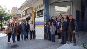
Local conference at Kerkini Lake | Wetland4Change | Wetland Flood Regulation
During the local events organized within the project, extensive reference was made to relevant measures already included in the Flood Risk Management Plans but whose implementation remains pending. These measures include: a) the development of a plan for the controlled flooding of lowland areas with high demand for flood protection; b) the designation of controlled flooding zones and the definition of permitted and prohibited land uses; and c) the implementation of natural water retention measures.
Our mapping and assessment results directly support these measures. We plan to submit them to the Ministry of Environment as documentation for specific wetland conservation and restoration measures to be integrated and funded within the flood risk management plan of the area. So far, involved competent authorities and stakeholders seem to give priority to wetland areas located within high flood-risk zones associated with a 100-year return period. Also, they have expressed interest for multi-functional wetland systems where flood attenuation could be combined with other ecosystem services such as biodiversity conservation, and sustainable wetland resource management, including grazing, ecotourism, and environmental education. One such particularly important proposal put forward by several stakeholders concerns the rehabilitation of the former Strymon riverbed.
Continue exploring Lake Kerkini
Flood regulation is only one part of the story. Discover how the Wetland4Change research at Lake Kerkini also explores carbon sequestration, governance and climate resilience through complementary scientific assessments and interviews.
Carbon Sequestration Interview
