

Protecting wetlands is not only an environmental challenge—it is also a question of governance, land management and long-term planning. As climate change intensifies, translating scientific knowledge into practical solutions requires stronger cooperation between researchers, policymakers, farmers and local communities.
Within the Wetland4Change project, ecosystem service assessments have gone beyond mapping carbon sequestration and flood regulation. The project has explored how these findings can support agricultural policies, guide wetland restoration priorities and strengthen adaptive management across the Strymon catchment. Particular attention has been given to aligning nature-based solutions with the European Union’s policy frameworks, including the Common Agricultural Policy (CAP), River Basin Management Plans and Flood Risk Management Plans.
In this interview, Anastasia Chatzimentor and Eleni Fitoka from the Greek Biotope/Wetland Centre (EKBY) discuss how ecosystem knowledge can support farmers, improve climate resilience, identify restoration priorities and foster a more collaborative approach to wetland governance—leaving behind not only scientific evidence, but also a practical blueprint for future decision-making.
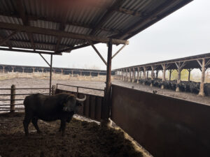
Kerkini Reservoir is surrounded by intensive agricultural activity. How can your models support farmers in aligning with Good Agricultural and Environmental Conditions (GAECs) while also improving environmental performance?
Kerkini Reservoir and the River Strymon catchment are strongly connected to the surrounding agricultural landscape, and for this reason many of the findings from our work can support a more ecosystem-based implementation of the Good Agricultural and Environmental Conditions (GAECs) standards under the EU Common Agricultural Policy (CAP). Three GAECs are particularly relevant to the outcomes of our work: GAEC 2 on the protection of wetlands and peatlands as carbon sinks, GAEC 4 on the protection of water from pollution and agricultural runoff, and GAEC 8 on the maintenance of non-productive areas and landscape features, including wetlands, for biodiversity. In this context, we are working closely with our associated partner, the Managing Authority of the CAP Strategic Plan of Greece, to support the more effective implementation of these standards—especially GAEC 2—by providing clearer guidance on how farming practices can contribute to wetland protection while also safeguarding the long-term sustainability of agricultural production and rural communities.
Research related to wetland carbon sequestration indicates that extreme water-level fluctuations should be avoided in order to maintain the stability of the lake’s carbon sequestration function. Abrupt fluctuations in water levels affect not only carbon dynamics, but also biodiversity, vegetation, and the overall resilience of the wetland system. Furthermore, the carbon sequestration modelling carried out under different water-level scenarios provides robust scientific evidence for defining acceptable limits to water-level extremes, thereby supporting compliance with the requirements of GAEC 2.
The results regarding the flood regulation capacity of wetlands across the Strymon catchment are also strongly connected to the objectives of GAEC 4. Our findings highlight the importance of conserving and restoring priority wetlands in order to mitigate flood impacts, protect water quality, and reduce agricultural runoff. Riparian zones along the Strymon River, identified as priority areas for conservation and restoration, not only contribute to flood protection but also filter pollutants and preserve the space needed for natural water dynamics, preventing agricultural activities from expanding too close to riverbanks. Similarly, the conservation of wet meadows and vegetated buffer strips along the lake and drainage channels constitutes an essential measure that can support farmers in meeting GAEC 4 requirements.
View this post on Instagram
In addition, another important aspect concerns the restoration and conservation of smaller landscape features, both inside and outside Natura 2000 areas, especially where they border agricultural land or grazing areas. Our wetland mapping across the Strymon catchment has provided detailed information on the location and extent of small wetlands and ponds, including sites as small as 0.1 ha, within agricultural landscapes. These features play an important role in enhancing biodiversity, supporting pollinators and natural pest control, improving ecosystem connectivity, and strengthening the resilience of both natural ecosystems and farming systems to climate pressures. This aligns closely with the objectives of GAEC 8, which calls for the protection of landscape elements as biodiversity features within agricultural landscapes.
Overall, our findings can support wetland conservation and restoration while generating multiple and mutually reinforcing benefits for agricultural sustainability and biodiversity, as well as enhancing ecological and climate resilience.
The project adopts a more process-based approach to ecosystem assessment. What are the key data and governance gaps that still need to be addressed to strengthen and operationalize this methodology?
It is a challenge to translate ecosystem assessment knowledge into operational initiatives, and this is precisely the objective of Wetland4Change, which promotes wetland conservation and restoration as a solution for climate resilience.
In this context, both a challenge and an opportunity arise from the growing acceptance of nature-based solutions. A particularly important opportunity is that the River Basin Management Plans and Flood Risk Management Plans (RBMPs–FRMPs) recognize the need to identify flood retention areas. We interpret this as a clear need to conserve and restore wetlands with a high capacity to regulate flood events. For this reason, it is essential that our results gain visibility among the authorities responsible for these management plans, so that together we can develop approaches to integrate the information we produce into management and decision-making processes.
More broadly, for wetlands to be effectively integrated into strategic planning for climate change adaptation and societal needs, the monitoring, analysis, and regular updating of key datasets must become systematic. Long-term time series should be collected for hydrological data, physicochemical quality, and biodiversity indicators. This is already supported through the Water Framework Directive and biodiversity policies. In addition, there is a need to connect carbon flux data with these factors in order to support more informed management and improve the monitoring and assessment of the climate impacts of human activities on wetlands.
Such datasets are generally available for large wetlands, such as lakes; however, for smaller wetlands, available data remain extremely limited. At the very least, our analysis indicates that these smaller wetlands must be incorporated into broader planning processes for water and flood management.
View this post on Instagram
At the governance level, the management of issues such as water levels and land ownership often remains fragmented across different institutions, while management-related data are not always easily accessible. This creates a particularly “grey” and unclear landscape that requires further investigation and stronger connections with management and land-use implications, especially in the case of wetlands located outside protected areas.
Again and again, the lack and fragmentation of information, limited accessibility of data, and the absence of collaboration and participatory approaches in decision-making processes come to the forefront. Gradually, we need to foster a stronger culture of collaboration, because all stakeholders must come together around the same table — the challenges we face demand it. This will also increase the likelihood of successfully implementing measures, even when these measures must remain adaptive in response to the uncertainties.
Have you identified specific priority areas where immediate intervention is needed—either to protect carbon stocks or to enhance flood resilience?
Yes, several priority areas for immediate intervention have been identified, particularly within the wider Strymonas floodplain. In terms of flood resilience, we have prioritized around 40 wetland sites capable of supporting water retention and flood attenuation in high-risk flood zones, where agricultural activities, settlements, and infrastructure are becoming increasingly vulnerable.
At the same time, together with local partners, we are working on the renaturalisation of sections of the original Strymon channel, a linear landscape feature that crosses the agricultural landscape and forms part of Kerkini National Park. This creates an opportunity to improve ecological connectivity between the river corridor, the lake, and the surrounding wet meadows, while also providing high-quality habitats for resident and migratory fauna. Beyond the biodiversity benefits, such interventions can also strengthen the relationship between local communities and smaller wetland areas, which are often overlooked in comparison to the lake itself, by enhancing their value as spaces for recreation and environmental identity.
Beyond the ecological and social benefits, these restoration actions are also expected to generate important climate-related benefits. Renaturalising the river corridor and its associated wetlands can increase primary productivity, improve carbon sequestration potential, and help mitigate greenhouse gas emissions, while simultaneously strengthening the landscape’s natural capacity to cope with floods and other climate-related pressures.
As the project reaches its conclusion, what is the most concrete management tool, framework or “blueprint” that you are leaving to local authorities and stakeholders?
As the project reaches its conclusion, the most concrete “blueprint” we leave to authorities and stakeholders is not a single technical tool, but rather a collaborative way of working: a model built on continuous communication, mutual understanding, and joint decision-making around climate change, environmental needs, and local community priorities. Through the project, we have strengthened a culture of dialogue in which local actors, communities, and environmental stakeholders become more aware of the climate-related benefits of wetland conservation and are better able to collectively respond to rapidly changing socio-ecological conditions.
At the same time, we are leaving behind a practical methodology for rethinking the role of wetlands in climate resilience. Public awareness of the importance of ecosystems as natural protection against extreme weather events is steadily growing, and this project has helped highlight that wetlands are valuable not only when they are large, like lakes, but also when they are small and locally distributed. Even smaller wetlands can play a crucial role in mitigating flood risks and can contribute in complementary yet decisive ways to broader flood management strategies.
Ultimately, the project’s legacy is not only scientific data, but also a framework for adaptive and participatory environmental governance — one that encourages local communities and institutions to continuously negotiate and maintain a balance between human activity, ecosystem protection, and climate adaptation under increasingly uncertain environmental conditions.
